         | ||||||||||||||||||||||||
During these early years, I needed to record more and more dense data. In 2003, Eric Varrel, David Lhomme and Yvan Robin joined me in the challenge to manage a new technology : 3D laser scanning. In july, I founded ATM3D, a pioneer company, which I was co-leader, production and technical developments manager. Focussing on Cultural Heritage and geological hazards (Eric Varrel speciality) at the beginning, my business has quickly grown and turned to high density 3D data management, whether from : I am able to combine data from multiple sources, to produce the full documentation of a project. In the 5 last years, I have been involved in more and more complex 3D scanning operations, and my experience has increasingly moved to special 3D scanning projects. My career blossomed since 2011, when I joined the Fugro group as the 3D scanning manager of Fugro Geoid. I'm now an expert in dense 3D data recording, processing and modeling, particularly in the fields of petrochemical industry, coastal and river engineering (ports, sea walls, dams), civil works (highways, tunnels and underground structures), and natural and industrial hazards (landslides, flood, after mine). I keep a special sensitivity for Cultural Heritage. I am also specialized in the management and development of true orthophotography, both in architectural and archaeological documentation, by terrestrial or aerial means. I manage the training of land surveyors students and new employees we welcome in the company.
The following map provides an at-a-glance view of the countries where I've successfully completed surveying and 3D scanning projects : 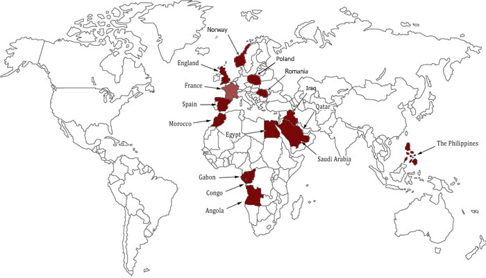
| ||||||||||||||||||||||||
 |
 Land surveying engineer, I created an agency in 1998 to bring my professional knowledge to Cultural Heritage. My goal was to provide and develop all key activities for the recording and processing of 3d data, for the study and the rendering of an archaeological site or a monument.